Source:
Wikipedia
Birkrigg stone circle
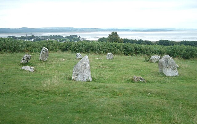
The Birkrigg stone circle (also known as the Druid's Temple or Druids' Circle) is a Bronze Age stone circle on Birkrigg Common, two miles south of Ulverston in the English county of Cumbria. It dates to between 1700 and 1400 BC.
Links
Images Gallery
Comments
Warning: count(): Parameter must be an array or an object that implements Countable in /www/htdocs/w01ac264/geo.io/cache/template/9d49048052681464cab33744e55c87efd2abb64d.file.comments.tpl.php on line 21
So far there are no reviews about the location.
Share your experience with others and write the first comment about the location
Source:
Wikipedia
Birkrigg stone circle
➴ Coordinates:
54° 9‘ N, 3° 5‘ W
Tags
Accessibility
Children
Weather
17. Mai 2024
N/A °
N/A
N/A
N/A
Wind
N/A k/h
Humidity
N/A
Visibility
N/A km